
A Case Study of Western Australia’s Wheatbelt Way
The Wheatbelt Way is a self-drive trail through the North Eastern Wheatbelt in Western Australia. It was launched in 2012 at Dowerin Field Day.
![]()
The Wheatbelt Way trail logo.
Background
The Wheatbelt Way was the brainchild of some hard-workng locals who wanted to raise awareness of the unique features and history of WA’s Wheatbelt, to attract visitors and to assist with economic development and viability in the region. The trail was created and is managed through a successful collaboration between eight local government authorities (LGAs) in the region. These LGA’s recognised that individually they could not create a drive trail or provide enough attractions for visitors. So, in partnership with the North Eastern Wheatbelt Travel Association (NEWTRAVEL) a voluntary not-for-profit local tourism association and the support of the North Eastern Wheatbelt Regional Organisation of Councils (NEWROC) the Wheatbelt Way self drive trail was created.
Wayfound has been involved with the Wheatbelt Way trail since its inception. Wayfound is a joint venture between Kirkgate Consulting specialists in tourism & economic development and design studio Tangelo Creative.
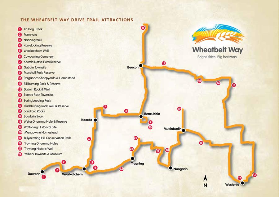
The Wheatbelt Way Drive trail – approximately 900 kms through the eight shires in the WA North Eastern Wheatbelt
Stage 1 – Feasibility & business case
The first stage involved David Duncanson of Kirkgate reviewing and refining the trail concept that had been devised by the local tourism association. This included surveying the route, confirming sites of interest, researching the tourism market and the viability/feasibility of the trail. This was then developed into a Master Plan and a robust Business Case which presented the economic benefits to the region from development of the Trail. An application was then developed for funding under the Royalties for Regions County Local Government Fund which was successful with $1.2 million being allocated to the project.
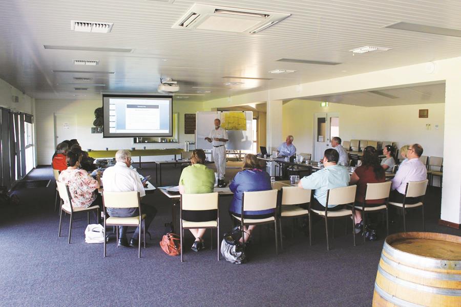
Wheatbelt Way development workshop at Mukinbuddin
Stage 2 – Establishing the drive trail
With the funding secured, the next stage was bringing the trail to life through:
- Consultation with residents, businesses, visitor centres and LGA representatives
- Creating a visual brand identity that would work well on signage, printed materials and online
- Mapping the trail and identifying wayfinding and interpretive content for all sites
- Installing appropriate tourism and recreation infrastructure at the identified trail sites, such as tables, seating, amenities, parking etc.
- Designing and creating all of the trail collateral – trail map, brochure, signage artwork and specification, recording the oral histories of locals, creating a website and an exhibition display
- Completion of a marketing plan for the launch and ongoing promotion of trail

Wheatbelt Way trail marker
The Results
The Wheatbelt Way started off with a solid foundation and a brand that the community endorsed. Supporter numbers have grown over the years as locals have seen the benefits in terms of increases in visitors and spending in the Wheatbelt.
The Wheatbelt Way has collected data on visitor numbers, length of stay, requests for information and estimated spend since 2012.
Interesting figures –
- A 66{8e6d983e74874acb387086f732b9e8bca692130348b310c73ee91b097eb7ecc6} increase in the number of travelling on the Wheatbelt Way and staying overnight at caravan parks– from just over 1000 in the July to October peak period in 2013 to just under 3000 (2942) in 2016.
- A 38{8e6d983e74874acb387086f732b9e8bca692130348b310c73ee91b097eb7ecc6} increase in visitor spending (from $189,000 to $304,000) for the July to October peak periods in 2013 and 2016.
- Nearly 500 requests for info to be sent are received each year via the Wheatbelt Way website. This has risen from about 20 requests in 2012.
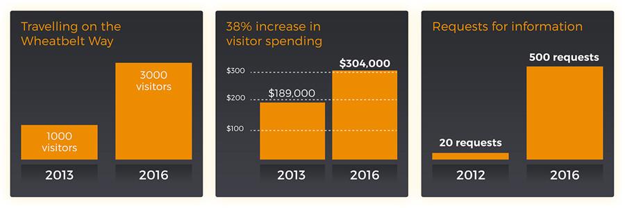
Wheatbelt Way economic growth documented for 2013 – 2016
Lessons learned
The success of the WBW in increasing visitor numbers and spending can be attributed to a number of factors that would be useful for other drive trail projects to consider.
These include:
- Joining with neighbouring Councils to create a regional experience as no individual Council had enough tourism product or resources to make a viable trail; plus it acknowledges the practicalities of visitors who don’t care about LGA boundaries
- Creating a not-for profit body to administer the trail – rather than giving responsibility to one council who has to manage it at the expense of other core responsibilities
- Ongoing funding for a trail project officer – one day per week – this is a local person
- Being open to continually evolving and improving the trail
- Seeking additional funding as required to continue to improve and develop the trail – for the app, website redevelopment
- Gathering visitor data from early on to gauge the impact of the trail and to identify areas for improvement
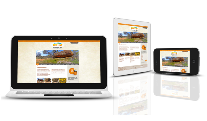
Wheatbelt Way – Responsive website
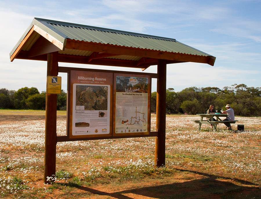
Wheatbelt Way Billburning Reserve Interpretive stop
What’s next?
Wayfound is currently working on creating a mobile app for the trail. This presents a great opportunity to reduce ongoing printing costs for the booklet while also giving an alternative means of accessing information to more digital savvy travellers. Recognising the remote and isolated locations (without phone and internet coverage) of many locations in WA, the app has safety features built in, such as registration and GPS triggered location data.
The app will also allow for better collection of visitor data, including itineraries, demographic information and length of stay at trail sites/along the route. Importantly, it will enable collection of email data for future marketing campaigns and encourage sharing of photos/experiences on social media.
This year, the Project Officer for the trail will be focusing on involving businesses more to engage with visitors travelling the WBW.
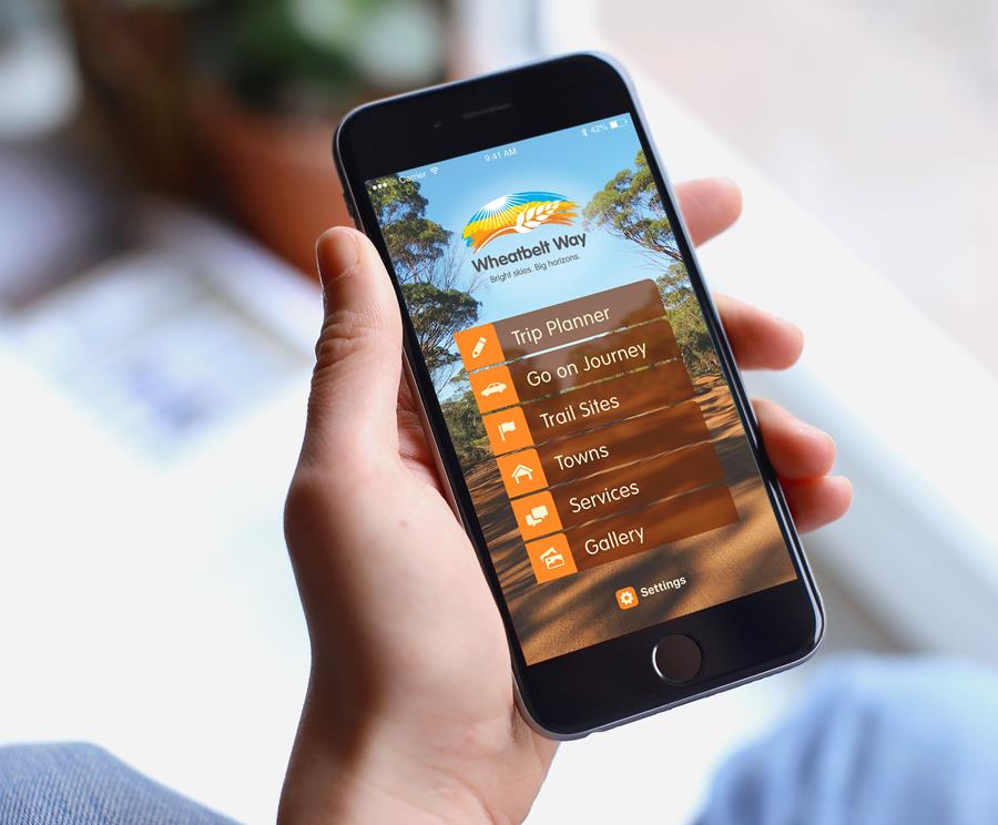
Wheatbelt Way phone app – currently under development
We are Wayfound
Wayfound is a specialist consultancy that thinks strategically about tourism. We consider the whole visitor journey and advise destinations on how to best provide information to get the tourism experience right.
We work with state and local government, regional development organisations and tourism organisations to create tourism initiatives. We apply our backgrounds in tourism, economic development, branding, marketing and signage design to bring a deep understanding to this work.
Wayfound’s services
We are visitor information and tourism specialists
- Destination visitor information strategies – audit and advice
- Business cases and grant/funding applications
- Destination branding, design and marketing
- Tourism websites, apps and online marketing
- Tourism signage services and signage strategies
- Creation of interpretive trails – drive trail specialists
For further information or to speak with our consultants please contact Kim on 0410 449 375.
Creating visitor journeys and experiences through seamless visitor information